Ile-de-France (Paris Suburbs) Map 1:1 v0.1.5c 1.57


Description:
Version 0.1.5c:
– Adapted for 1.57 game version
This is a standalone map
Scale 1:1
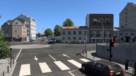
The cities of Rony-sous-Bois, Charenton-le-Pont, Saint-Mande, Vincennes, Bagnolet, Villiers-sur-Marne and the 12th and 20th arrondissements of Paris
Motorways A3, A4, A86, A103 and A186
Real companies: SNCF, Bercy 2, La Poste, Carrefour, Eiffel, SFCP, Westfield Rosny 2, Marché Grand Frais, Castorama and Rosny-sous-Bois farming companies
Beautiful views
Realistic interchanges
Credits:
Georges93